
HEC-RAS flood studies and river modelling in Chile
HEC-RAS 1D/2D modelling, water surface profiles, flood and debris-flow risk.
What we do
We model rivers and streams in 1D and 2D to obtain water levels, velocities and flood extents for different return periods.
With those results we design river protection works, check bridges and culverts, define water surface profiles and assess flood and debris-flow risk for a site.
When you need it
- Before building next to a watercourse or in an area mapped as flood-prone by the local zoning plan.
- For a river channel modification (PAS 156) or any in-stream works requiring DGA approval.
- To support gravel extraction or river protection works before the DOH or the municipality.
- When a ravine can produce mud or debris flows.
Software and standards
HEC-RAS and GeoHEC-RAS (1D and 2D), IBER, HEC-HMS, QGIS and ArcGIS Pro. Chilean DGA, DOH and SEA criteria.
Typical deliverables
- Hydrology report with design flows
- Calibrated hydraulic model
- Flood maps with and without the project
- Longitudinal profiles and cross-sections
- Design report for protection works
- Editable calculation spreadsheet
What we need from you
Project location, river survey or bathymetry (we can arrange it), project drawings and permit deadlines.
Timelines
Mostly driven by the available survey and whether bathymetry is needed. Once the survey is ready, modelling and reporting move quickly; the exact schedule is set in the proposal.
Frequently asked questions
What is the difference between 1D and 2D modelling?
1D represents the river with cross-sections and suits well-defined channels. 2D computes flow over the whole terrain and shows how water spreads over floodplains, overflows and confluences. In many studies we run both and compare.
Which return periods are used in Chile?
It depends on the authority and the structure; 100 years is typical, with checks for 150 years or more for sensitive works.
Is a drone survey enough?
For the banks, yes. The submerged channel requires bathymetry.
River hydraulics and hydrology
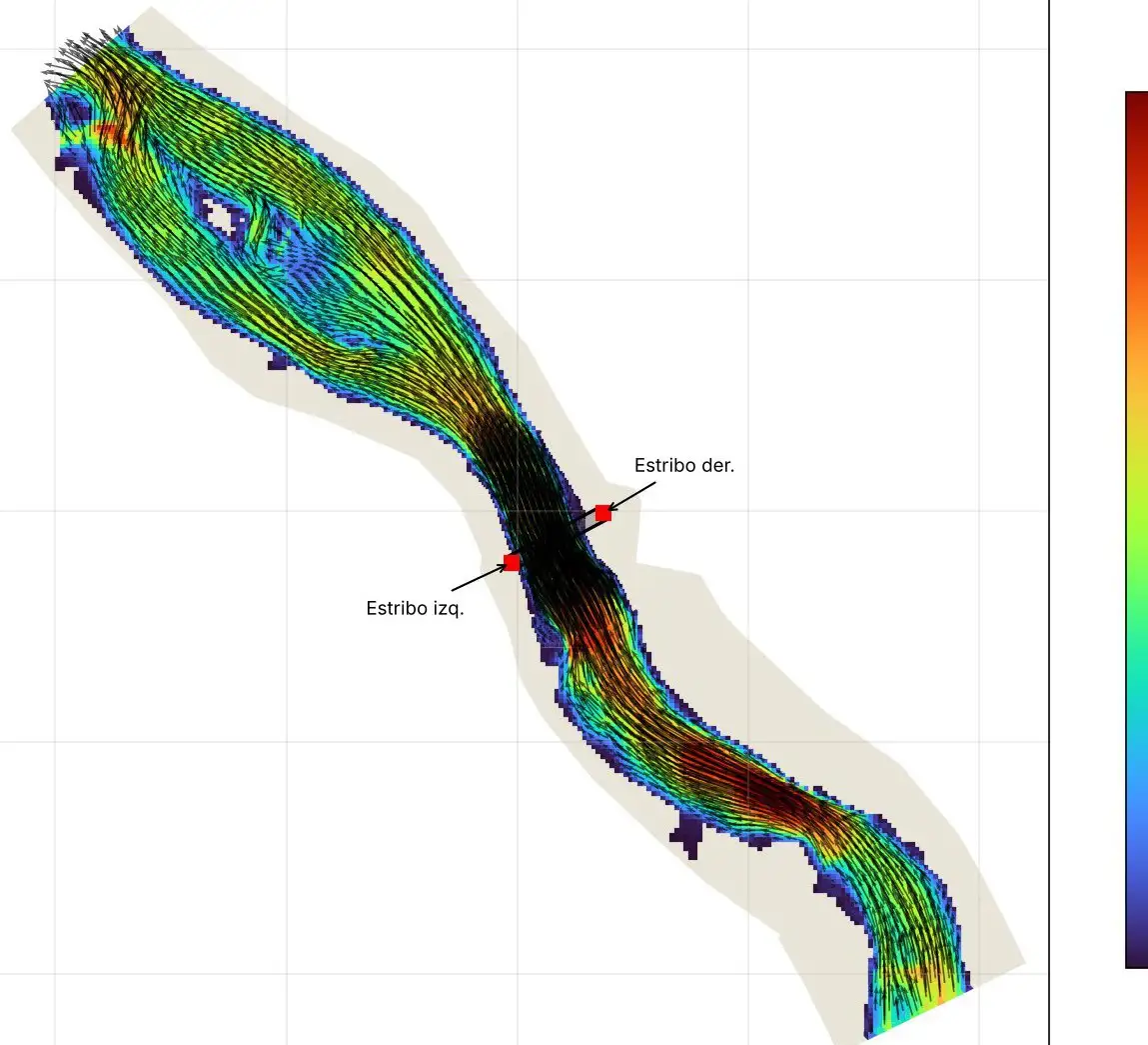
Bridge abutment protection and gravel extraction, Llaquepe river
HEC-RAS 1D and 2D modelling to protect bridge abutments and define a gravel extraction area.
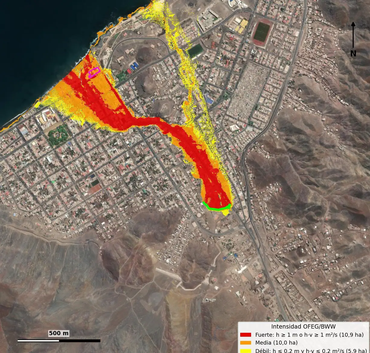
Debris-flow risk study for an urban ravine, Taltal
2D debris-flow modelling to assess the exposure of an urban property.
turbiascaliboro: turbidity forecasting model and alert app
A model that anticipates turbidity events at the water intake and publishes them in an alert app.
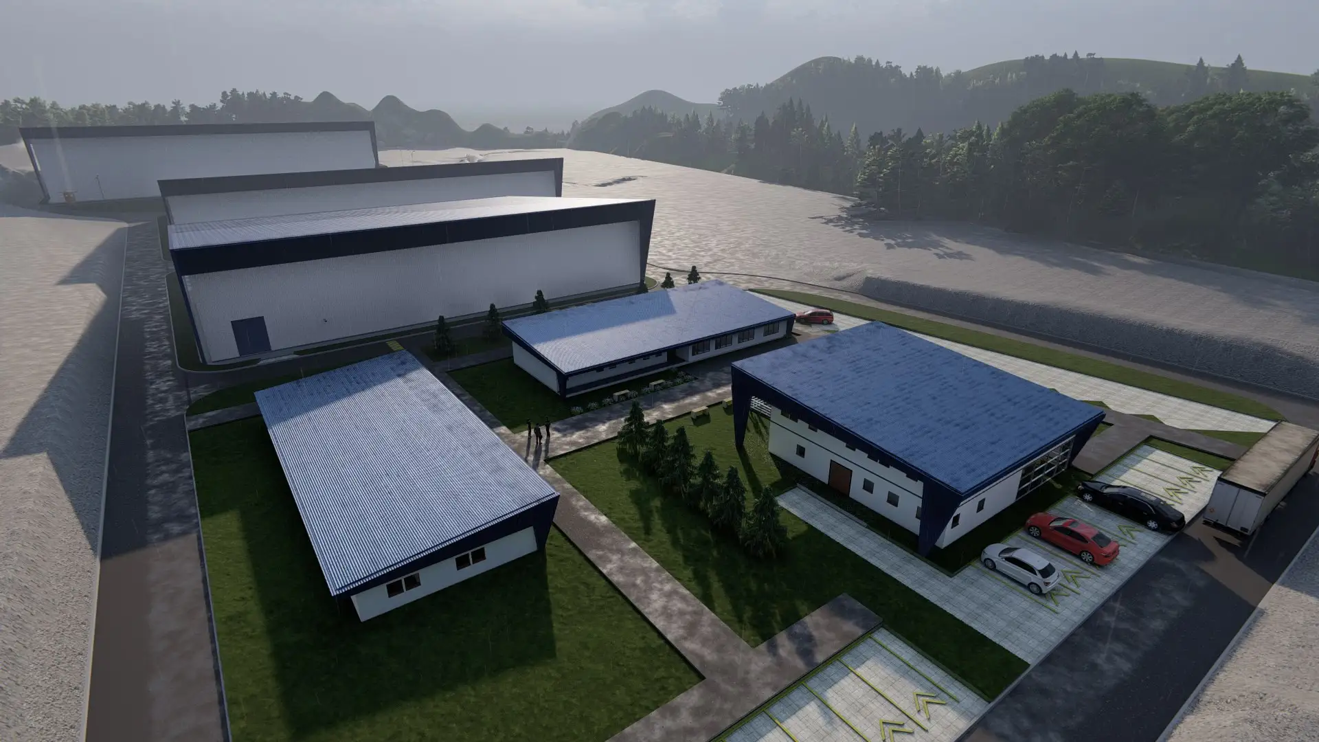
Environmental assessment for a hatchery expansion
Hydraulic sectoral permits, water resources report and renders for a hatchery expansion assessment.
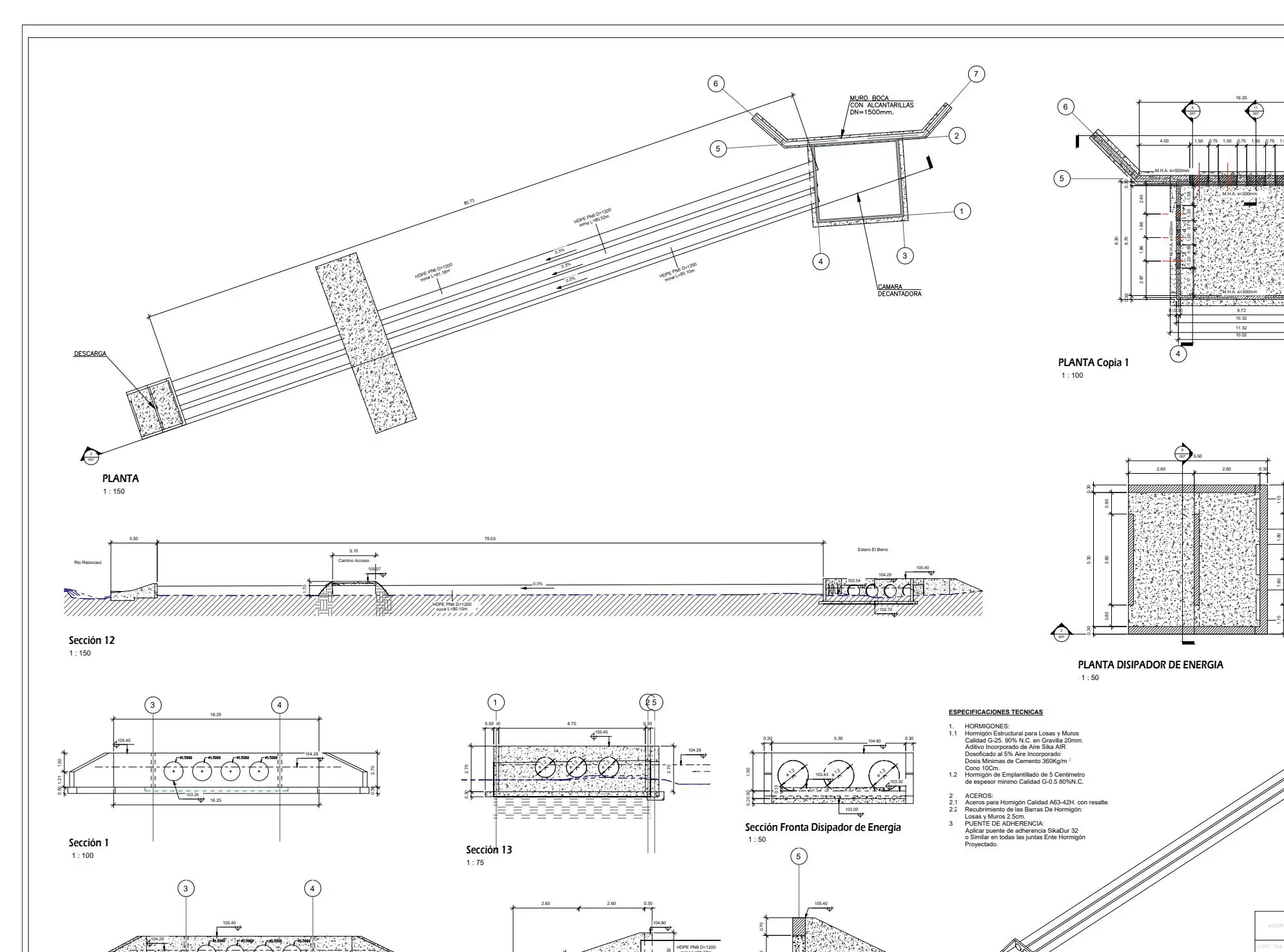
Sectoral environmental permits for hatchery assessments
Hydraulic component of PAS 155, 156 and 157 permits for hatchery environmental assessments, alongside environmental consultancies.
Working on something similar?
Tell us the location, type of works and timeline. We will reply with a scope and a proposal.